ทัศนียภาพแปลกๆ ฝีมือมนุษย์ดูได้ด้วยดาวเทียมของกูเกิล
Landscapes Created by Human Hands
and can be viewed by Google Satellite
by Phaitoon Yaemprasuan
Special Experienced Teacher of Information and Communication Technology Strand
SOURCE : WWW.BIGPICTURE.RU
These buildings landscapes had been created by human hands in Florida, U.S.A., and they are viewed by Google Satellite
ทัศนียภาพของอาคารบ้านจัดสรรเหล่านี้ ถูกสร้างด้วยน้ำมือมนุษย์เรานี่แหละ มันอยู่ในรัฐฟลอริดา (รัฐนี้อยู่ชายฝั่งมหาสมุทรแอ็ตแลนติก ตะวันออกเฉียงใต้ของสหรัฐอเมริกา ซึ่งมีสภาพดินฟ้าอากาศคล้ายๆ ประเทศไทย อุดมสมบูรณ์)
มองดูจากคอมพิวเตอร์ ด้วย Google Satellite
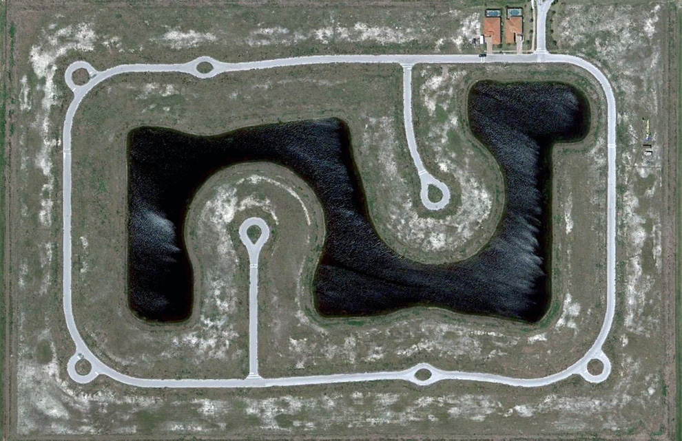
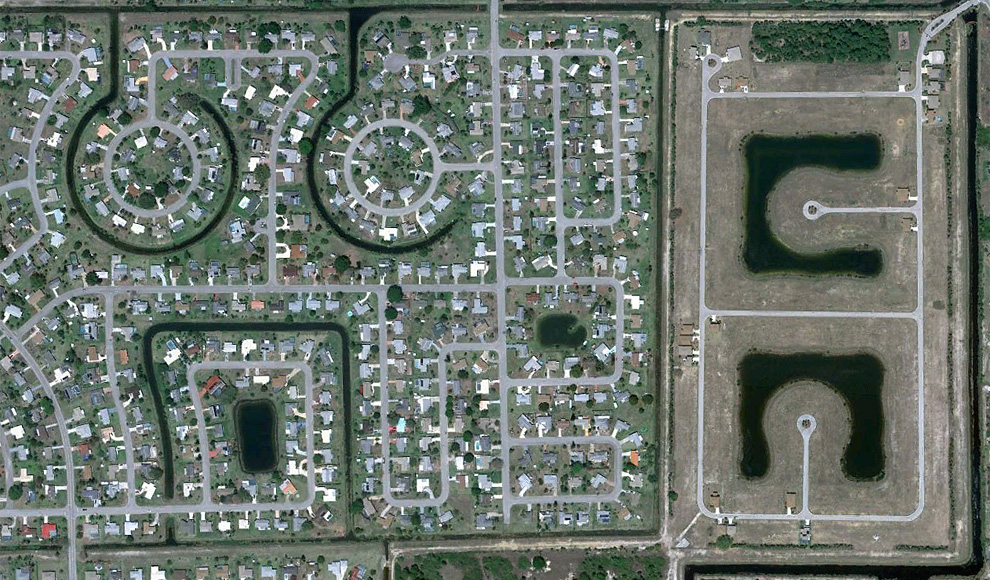
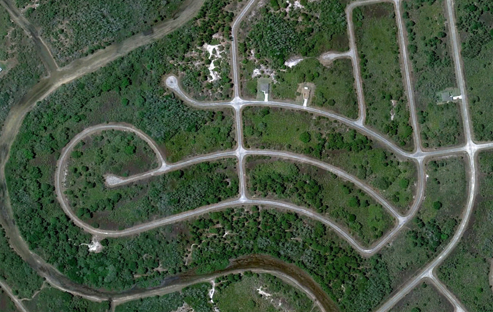
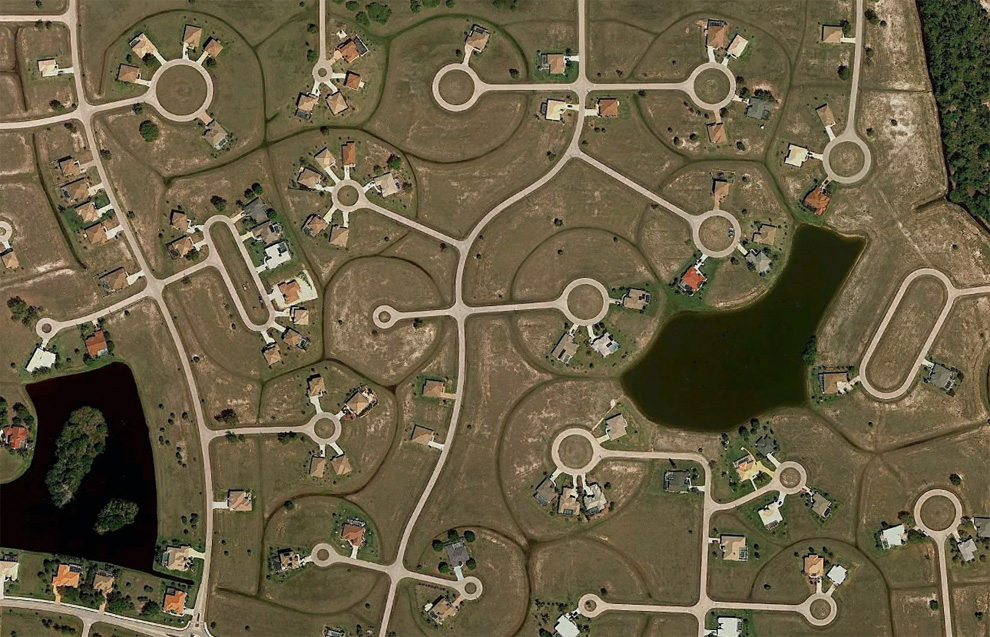
1. Section partially built-up residential project with only two houses near Fort Myers, State of Florida . (© Google) โครงการก่อสร้างที่อยู่อาศัย ด้วยบ้านแค่ 2 หลัง ใกล้กับค่ายทหาร ฟอร์ตไมเออร์ มลรัฐฟลอริดา สหรัฐอเมริกา
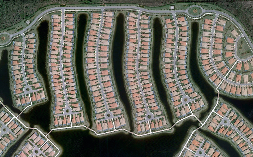
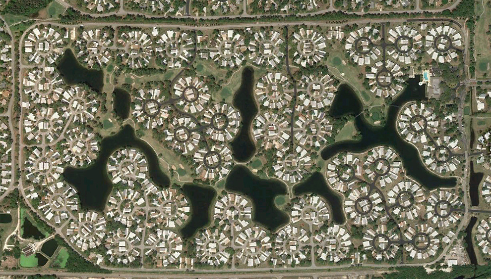
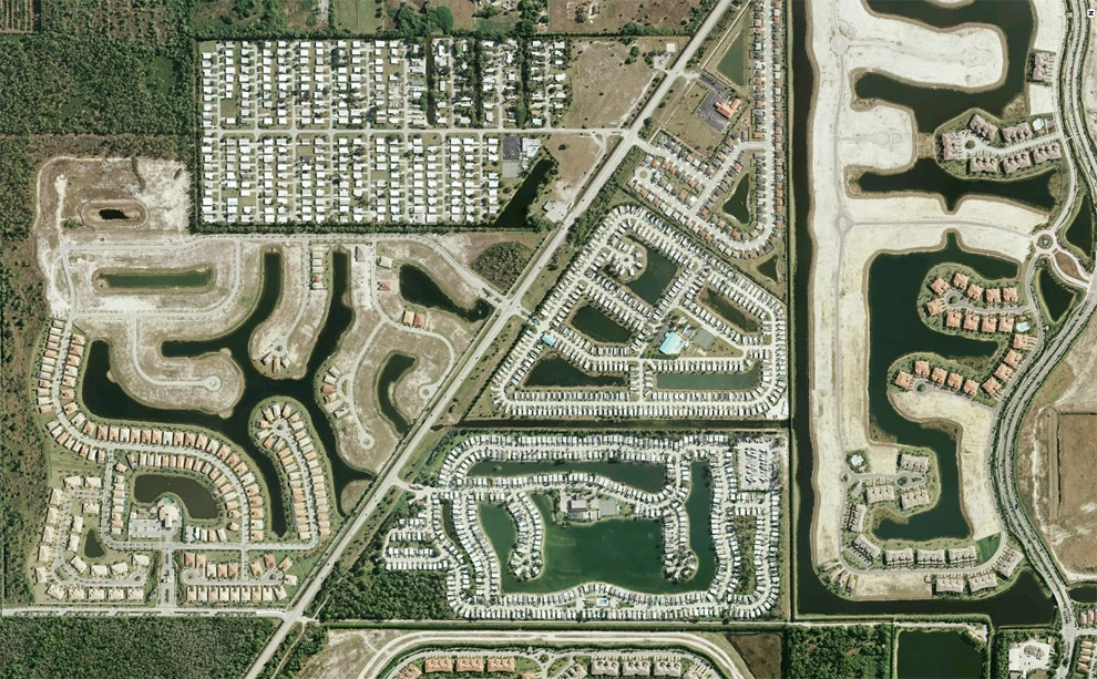
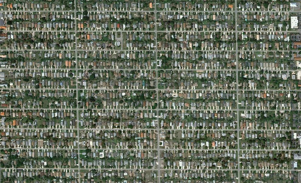
These buildings landscapes had been created by human hands in Florida, U.S.A., and they are viewed by Google Satellite
ทัศนียภาพของอาคารบ้านจัดสรรเหล่านี้ ถูกสร้างด้วยน้ำมือมนุษย์เรานี่แหละ มันอยู่ในรัฐฟลอริดา (รัฐนี้อยู่ชายฝั่งมหาสมุทรแอ็ตแลนติก ตะวันออกเฉียงใต้ของสหรัฐอเมริกา ซึ่งมีสภาพดินฟ้าอากาศคล้ายๆ ประเทศไทย อุดมสมบูรณ์)
มองดูจากคอมพิวเตอร์ ด้วย Google Satellite

1. Section partially built-up residential project with only two houses near Fort Myers, State of Florida . (© Google) โครงการก่อสร้างที่อยู่อาศัย ด้วยบ้านแค่ 2 หลัง ใกล้กับค่ายทหาร ฟอร์ตไมเออร์ มลรัฐฟลอริดา สหรัฐอเมริกา

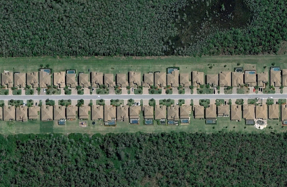
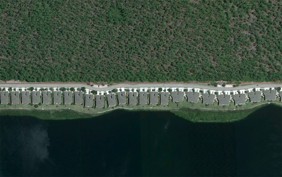
2. The strip of houses in the south-eastern part of Fort Myers. (© Google)
แนวหมู่บ้าน ทางคะวันออกเฉียงเหนือของฟอร์ตไมเออร์
แนวหมู่บ้าน ทางคะวันออกเฉียงเหนือของฟอร์ตไมเออร์

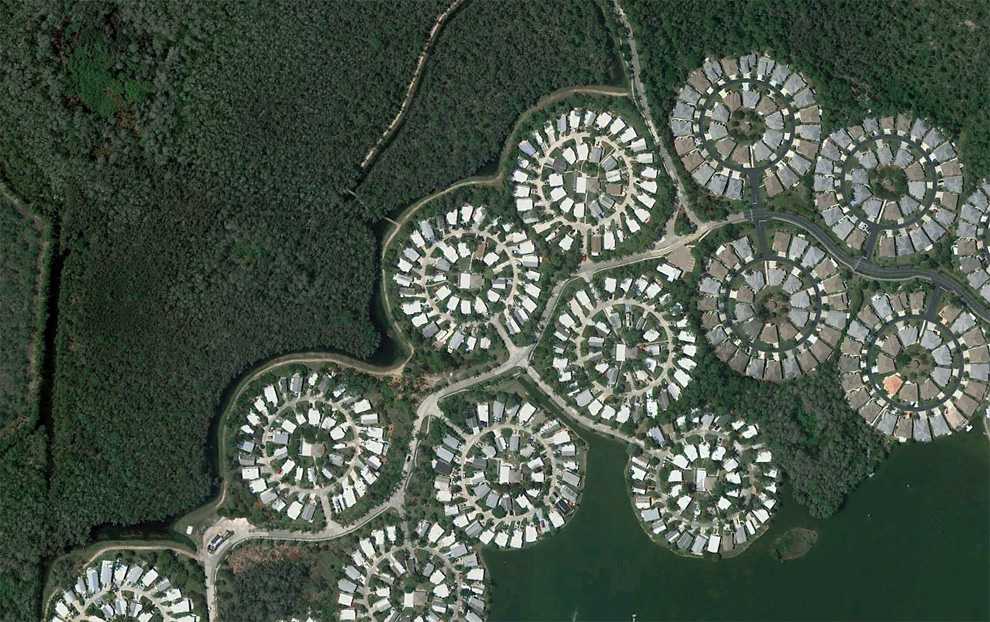
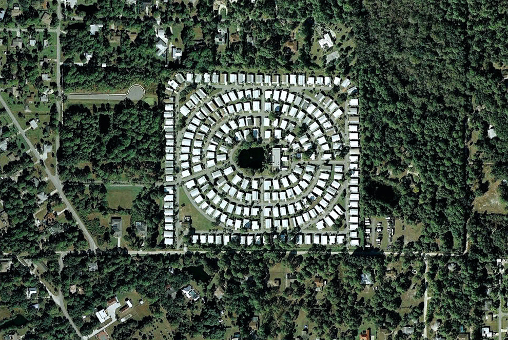
3. The circular sections with houses near the highway I-75. (© Google)
หมู่บ้าน เป็นกระจุกวงกลม ริมถนน ไอ-75
หมู่บ้าน เป็นกระจุกวงกลม ริมถนน ไอ-75

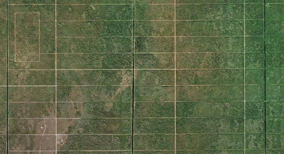
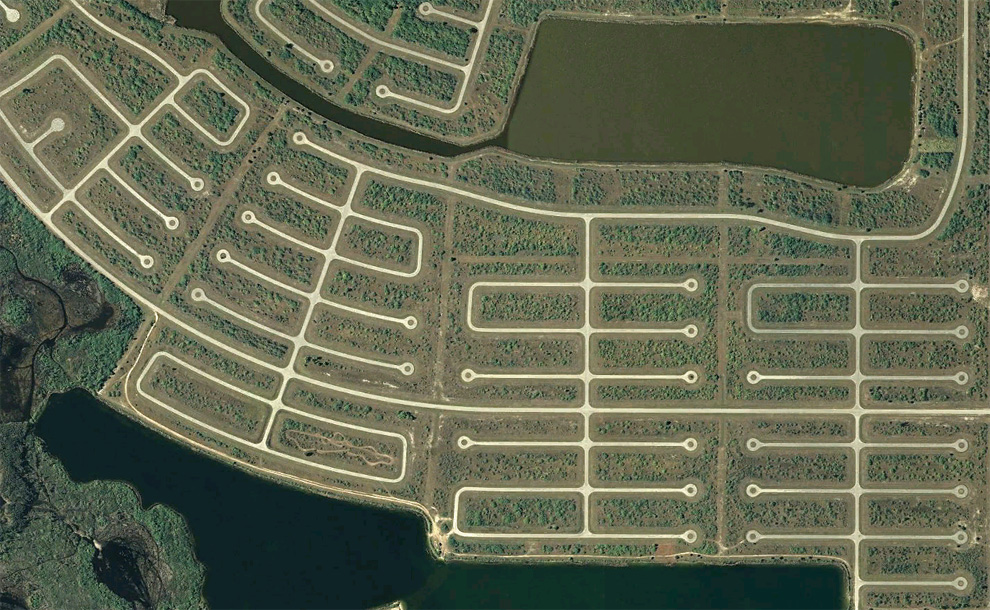
4. This area is in the 23067 hectares called "Mansions Goldent Gates" was the largest in America in the 1960s. Were built canals and roads, but eventually went bankrupt construction company. Over the past 20 years or so, the earth moved and turned into a state forest Picayune Strand. (© Google / USGS)
เขตพื้นที่จัดสรร ขนาด 2306 เฮกตาร์ (ราว 4600 กว่าไร่) เรียกว่า "คฤหาสถ์ประตูทอง" ตั้งแต่ทศวรรษ 1960 มีการสร้างคลองและถนน แต่เจ้าของโครงการประสบกับการล้มละลายเสียก่อน โครงการเลยค้างเติ่งมา 20 กว่าปี จนมีต้นไม้ขึ้นอยู่เขียวพรืดไปหมด
เขตพื้นที่จัดสรร ขนาด 2306 เฮกตาร์ (ราว 4600 กว่าไร่) เรียกว่า "คฤหาสถ์ประตูทอง" ตั้งแต่ทศวรรษ 1960 มีการสร้างคลองและถนน แต่เจ้าของโครงการประสบกับการล้มละลายเสียก่อน โครงการเลยค้างเติ่งมา 20 กว่าปี จนมีต้นไม้ขึ้นอยู่เขียวพรืดไปหมด

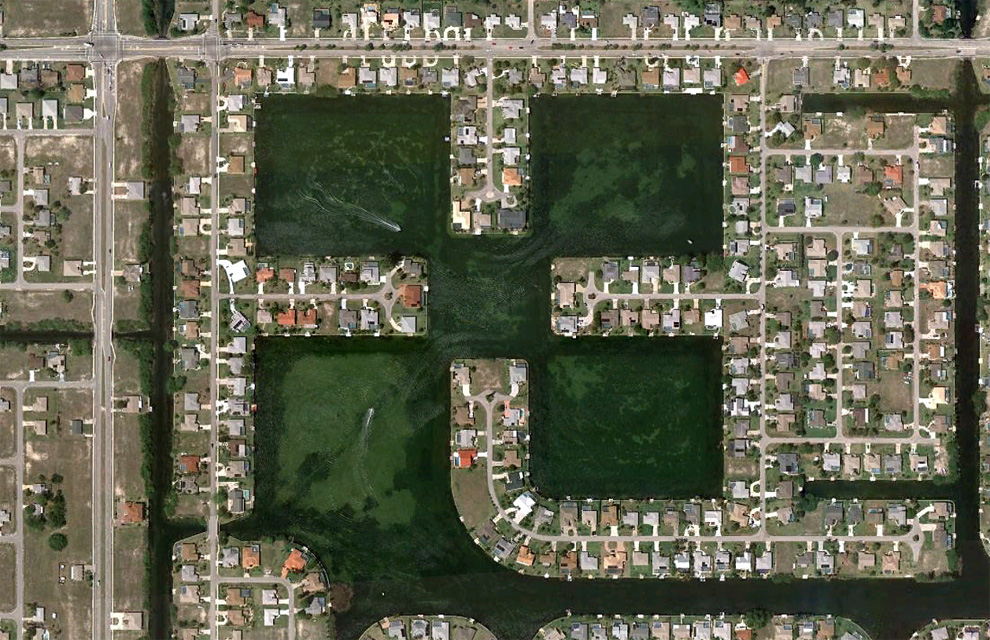
5. Boats sail through the channels in the northern part of Cape Coral, Florida. (© Google)
หมู่บ้านจัดสรรในรัฐฟลอริดา สหรัฐอเมริกา มีช่องให้แล่นเรือเข้าไปเทียบยันบ้านได้หมด
หมู่บ้านจัดสรรในรัฐฟลอริดา สหรัฐอเมริกา มีช่องให้แล่นเรือเข้าไปเทียบยันบ้านได้หมด

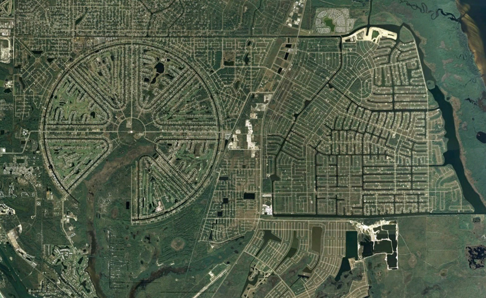
6. The rotunda area Vastu, originally built up in the 1960s, has not been completed. It is located in Charlotte County, Florida. (© Google / Data SIO, NOAA, US Navy, NGA, GEBCO)
"วาสตู" เป็นพื้นที่ราบลุ่ม เป็นโครงการจัดสรรที่ดินขนาดใหญ่มาก เริมสร้างโครงการในช่วงทศวรรษ 1960 แต่ไม่เสร็จ
"วาสตู" เป็นพื้นที่ราบลุ่ม เป็นโครงการจัดสรรที่ดินขนาดใหญ่มาก เริมสร้างโครงการในช่วงทศวรรษ 1960 แต่ไม่เสร็จ

7. Densely populated area in Bonita Springs. (© Google)
บ้านจัดสรร เมืองโบนิตาสปริงส์
บ้านจัดสรร เมืองโบนิตาสปริงส์

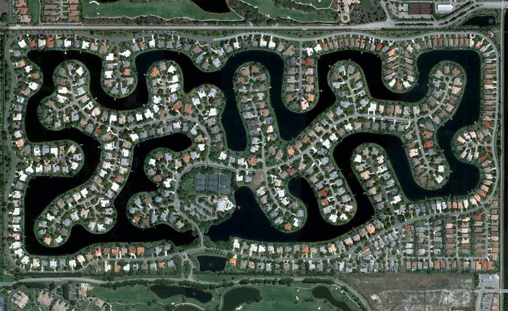
8. Area, built up around an artificial lake in the south-eastern part of the Bonita Springs, Florida. (© Google)
เป็นส่วนหนึ่งของโครงการ เมืองโบนิตาสปริงส์ มีการขุดทะเลสาปจำลองรายรอบหมู่บ้านด้วย
เป็นส่วนหนึ่งของโครงการ เมืองโบนิตาสปริงส์ มีการขุดทะเลสาปจำลองรายรอบหมู่บ้านด้วย

9. Dead ends in the southern area of the Rotunda Vastu in Charlotte County. (© Google)
สุดทางของโครงการจัดสรร"วาสตู"
สุดทางของโครงการจัดสรร"วาสตู"

10. Built-up area and the nearby, which is under construction in Lehigh Acres. (© Google)
โครงการจัดสรรที่ดินอีกแห่ง ซึ่งอยู่ใกล้กัน
โครงการจัดสรรที่ดินอีกแห่ง ซึ่งอยู่ใกล้กัน

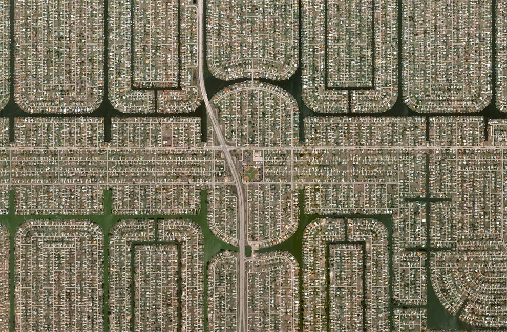
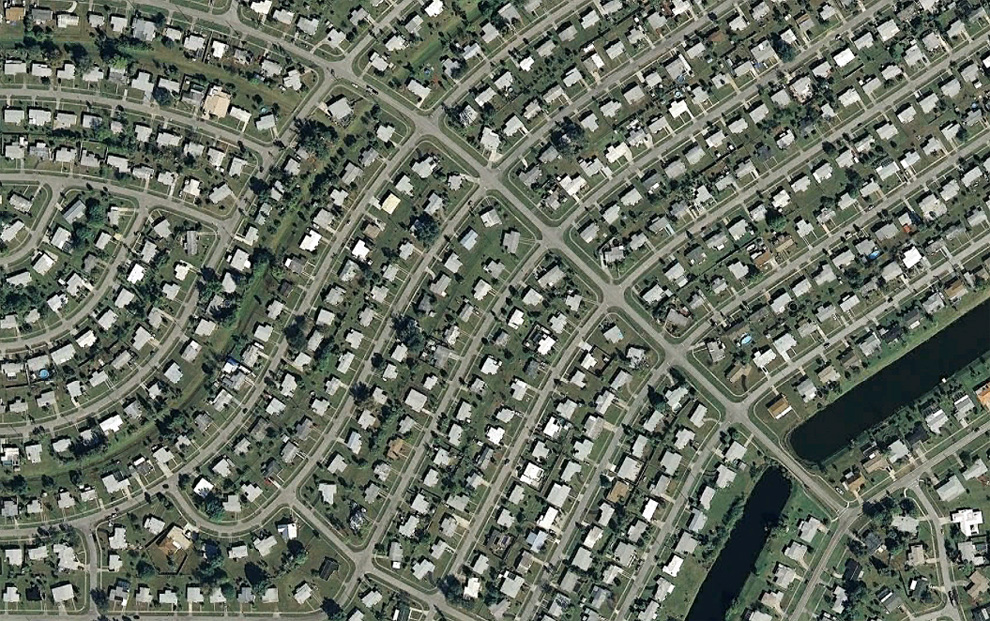
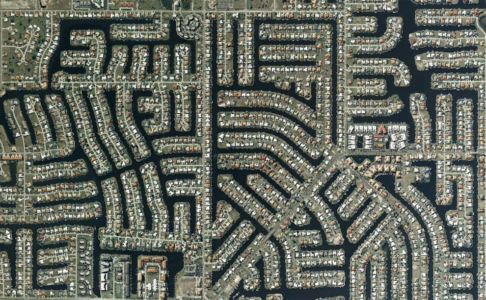
11. Densely populated area of Cape Coral, Florida. (© Google)
พื้นที่ที่มีประชากรอยู่หนาแน่น ในเขตแหลมคอรัล (แหลมปะการัง) มลรัฐฟลอริดา อเมริกา
พื้นที่ที่มีประชากรอยู่หนาแน่น ในเขตแหลมคอรัล (แหลมปะการัง) มลรัฐฟลอริดา อเมริกา

12. Construction near North Fort Myers River Kalusahetchi. (© Google / Europa Technologies)
โครงการจัดสรรที่ดิน ทางเหนือของค่ายทหารฟอร์ไมเออร์
โครงการจัดสรรที่ดิน ทางเหนือของค่ายทหารฟอร์ไมเออร์

13. Partially built up, and now partially overgrown area in Lehigh Acres. (© Google)
นี่ก็เป็นโครงการจัดสรรที่ดิน ที่อยู่บริเวณใกล้ๆ กัน
นี่ก็เป็นโครงการจัดสรรที่ดิน ที่อยู่บริเวณใกล้ๆ กัน

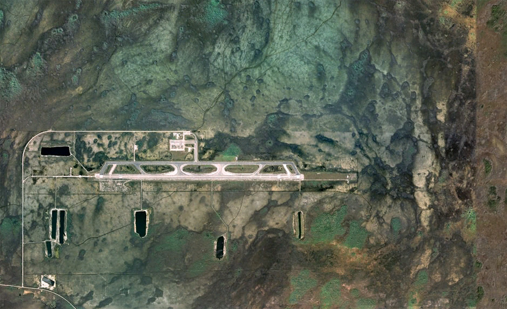
14. Airport «Dade-Collier Training and Transition Airport» airport was originally planned as a jet aircraft «Everglades Jetport». Its construction began in 1968 and it was planned as the largest airport with six lanes to support SuperSpeed traffic. Because of the nearby Big Cypress Preserve airport construction was suspended, and when the much-hyped "super fast" airport does not live up to his expectations, the project was left as is. (© Google / USGS / DigitalGlobe)
สนามบิน สำหรับการฝึกนักบิน สร้างมาตั้งแต่ปี 1968 กะว่าจะให้ใหญ่โตขนาด 6 ช่อง
สนามบิน สำหรับการฝึกนักบิน สร้างมาตั้งแต่ปี 1968 กะว่าจะให้ใหญ่โตขนาด 6 ช่อง

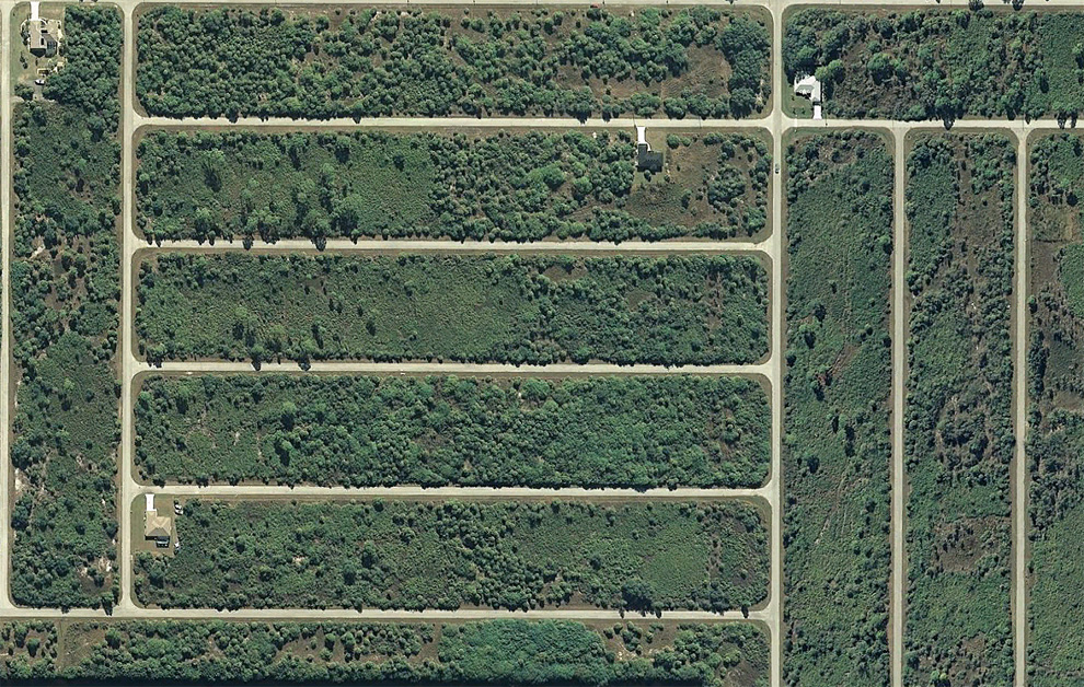
15. "Grate" unimproved alleys in the west Port Charlotte, Florida. (© Google)
นี่ก็เป็นเขตจัดสรรที่ดินในรัฐฟลอริดาอีกแห่ง ที่ถูกทิ้งโครงการ
นี่ก็เป็นเขตจัดสรรที่ดินในรัฐฟลอริดาอีกแห่ง ที่ถูกทิ้งโครงการ

16. Area in Port Charlotte, Florida. (© Google)
โครงการบ้านจัดสรร ท่าเรือเมืองชาล็อตต์ รัฐฟลอริดา
โครงการบ้านจัดสรร ท่าเรือเมืองชาล็อตต์ รัฐฟลอริดา

17. Partially built-up area near the harbor of Charlotte, north of Fort Myers. (© Google)
โครงการจัดสรรที่ดินอ่าวชาร์ล็อตต์
โครงการจัดสรรที่ดินอ่าวชาร์ล็อตต์

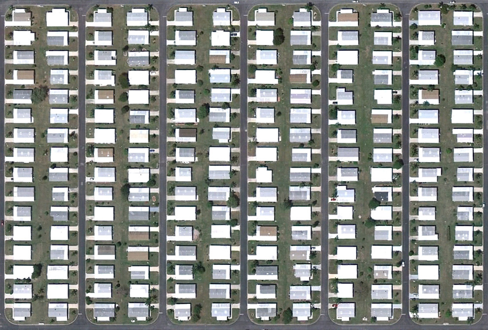
18. Houses in a row along a man-made lake near Naples, Florida. (© Google)
หมู่บ้านเป็นแนวยาวริมทะเลสาบที่มนุษย์ขุดขึ้น รัฐฟลอริดา
หมู่บ้านเป็นแนวยาวริมทะเลสาบที่มนุษย์ขุดขึ้น รัฐฟลอริดา

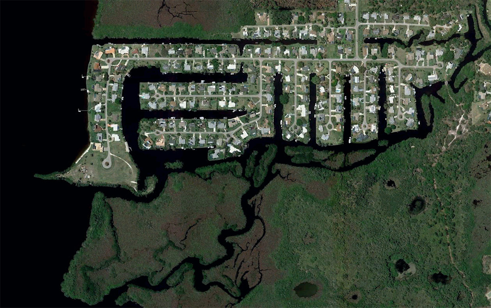
19. Canals and homes in Charlotte Park, south of Port Charlotte, Florida. (© Google / Europa Technologies)
หมู่บ้านจัดสรร ที่เป็นคลอง ปาร์กชาร์ล็อตต์ ทางใต้ของท่าเรือชาร์ล็อตต์
หมู่บ้านจัดสรร ที่เป็นคลอง ปาร์กชาร์ล็อตต์ ทางใต้ของท่าเรือชาร์ล็อตต์

20. Built-up piece of land north of Eaglewood. (© Google)
โครงการจัดสรร เมืองอีเกิลวู้ด
โครงการจัดสรร เมืองอีเกิลวู้ด

21. Part of Verona Walk - an area in Naples, Florida. (© Google)
นี่ก็เป็นอีกที่หนึ่ง ในรัฐฟลอริดา
นี่ก็เป็นอีกที่หนึ่ง ในรัฐฟลอริดา

22. Houses in round areas north of North Fort Myers. (© Google)
หมู่บ้านจัดสรร ตอนเหนือของค่ายทหารฟอร์ไมเออร์
หมู่บ้านจัดสรร ตอนเหนือของค่ายทหารฟอร์ไมเออร์

23. A series of residential buildings in various stages of completion along the highway to the south of Naples, Florida. (© Google / USGS)
กลุ่มของบ้านจัดสรร ริมทางหลวง เมืองเนเปิลส์ รัฐฟลอริดา
กลุ่มของบ้านจัดสรร ริมทางหลวง เมืองเนเปิลส์ รัฐฟลอริดา

24. Naples Park - the densely populated area north of Naples. (© Google)
เนเปิลปาร์ก ย่านประชากรหนาแน่น
เนเปิลปาร์ก ย่านประชากรหนาแน่น

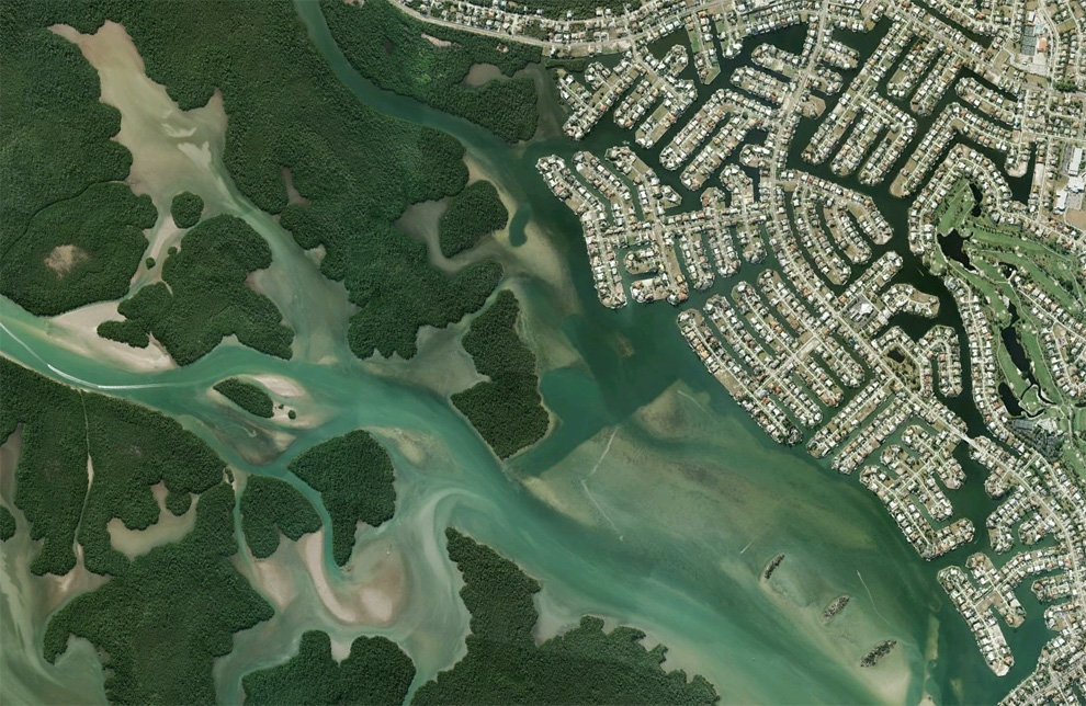
25. Channels and houses near the river Big Marco in Marco Island, Florida. (© Google / USGS)
บ้านจัดสรรริมแม่น้ำบิ๊กมาร์โค ของเกาะมาร์โค รัฐฟลอริดา
บ้านจัดสรรริมแม่น้ำบิ๊กมาร์โค ของเกาะมาร์โค รัฐฟลอริดา

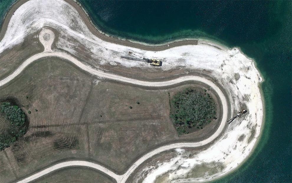
26. Construction equipment stands at an artificial lake in the south-eastern part of the Fort Myers, Florida. (© Google)
อุปกรณ์การก่อสร้าง ณ ทะเลสาบจำลอง ที่ทางตะวันตกเฉียงใต้ของค่ายทหารฟอร์ตไมเออร์
อุปกรณ์การก่อสร้าง ณ ทะเลสาบจำลอง ที่ทางตะวันตกเฉียงใต้ของค่ายทหารฟอร์ตไมเออร์

No comments:
Post a Comment